![]()
|
Geology for Fossil Hunters
|
|
|
What’s the best way to find a fossil? Find a geologist.
Fossilized creatures don’t appear just anywhere. They’re usually found in soil or rock that was formed at roughly the same time the creature lived. The first step in finding a fossil is locating the geologic zone where it’s most likely to be found, and that’s where a geologist’s help can come in handy. Geologists use survey maps like this one to help find fossils. Once a fossil is found, a geologist can also help figure out how old it is by dating the rock in which it was found. |
|
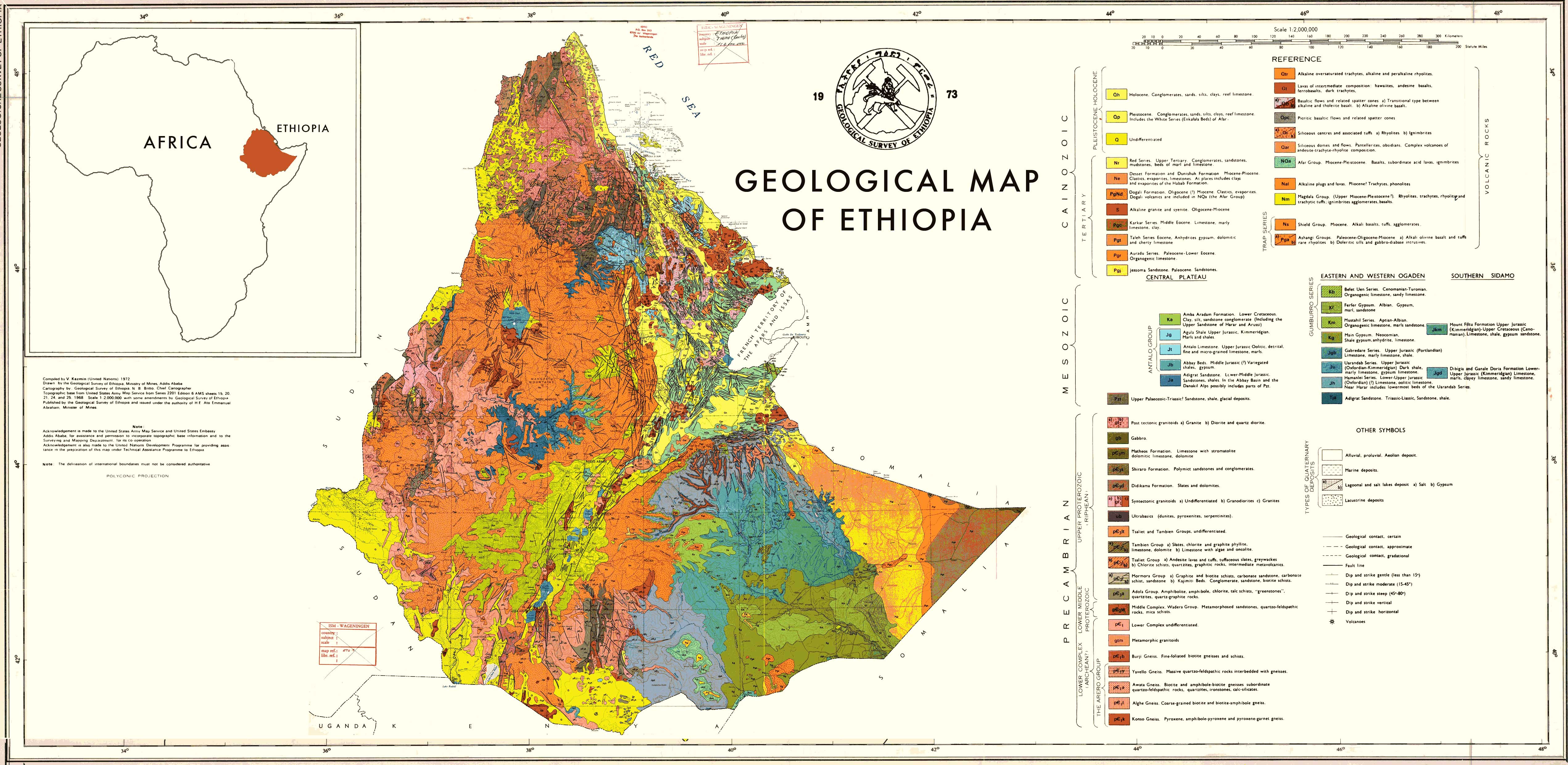
Click on map image to open large version in a new window |
|
|
|
|
|
|
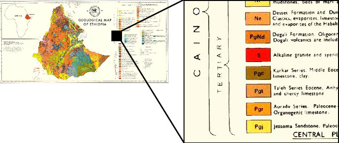
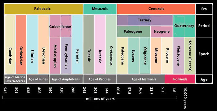
| The colors in this key identify different rock types of different ages—younger rocks on top; older rocks below. Geologists use names like Precambrian and Mesozoic to describe the age of a rock formation—words that send most people to the dictionary. We’re looking for hominid fossils less than 5 million years old, so we’re only interested in relatively young rock, mainly from the Quaternary (Pleistocene and Holocene) and Tertiary periods. | |
|
|
|
Cenozoic:
66 million years ago to present
Quaternary : 1.6 million years ago to present Holocene : 10,000 years ago to present Pleistocene : 1.6 million years ago to 10,000 years ago Tertiary : 66 million years ago to 1.6 million years ago Mesozoic : 245 million years ago to 66 million years ago Paleozoic : 545 to 245 million years ago Precambrian : 545 million years and older |
|
|
|
|
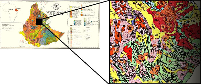
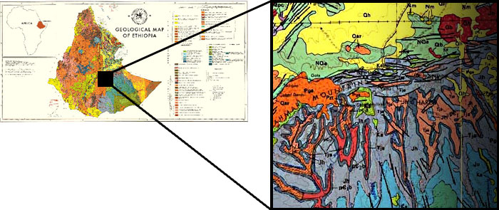
| This pink area is a lava flow, quite common here in the East African Rift Zone. We’re not likely to find fossils in the volcanic rocks themselves (though impressions of ancient footprints have been found in volcanic ash), but geologists can use lava flows to establish the age of the fossils we do find. By using techniques like paleomagnetism and argon-argon dating, layers of lava that sandwich a fossil can reveal its approximate age. This works because we know that the fossil must be younger than the lava layer beneath it, and older than the lava layer above it—a technique known as relative dating. | |
|
|
|
|
|
| Several famous hominid fossils have been found here at Hadar in the Awash River Valley of Ethiopia, including Lucy, a 3-million-year-old Australopithecus afarensis who is one of our most ancient known relatives. Lucy’s remains survived thanks to a rare circumstance: She died on an ancient lakeshore and was promptly covered by silt and sand. | |
|
|
|
|
|
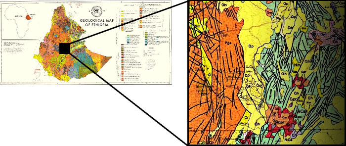
| These black lines are fault lines, areas where broken edges of the earth’s crust scrape up against one another. Why so many? Ethiopia is in the East African Rift Zone, a part of Africa that is tearing apart, thanks to tectonic forces. The gradual stretching apart of the land in this area has left faults in the rock and caused lava flows. | |
|
|
|
|
|
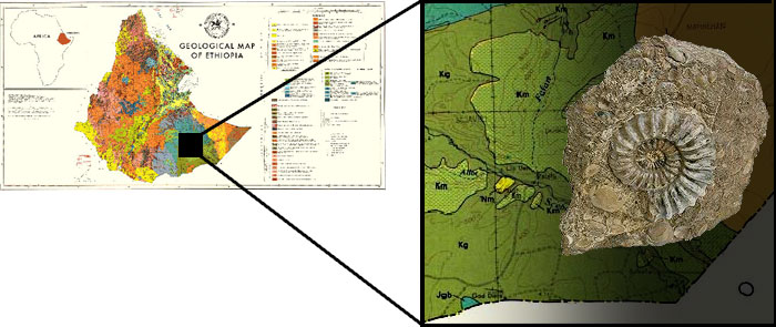
| Fossil hunters who come across specimens like this ammonite know their chances of finding the remains of ancient hominids nearby are pretty low. One way to date a lesser-known fossil is to compare it with a better-known fossil found with it. These “index fossils”—organisms that lived only during a known span of time—are especially useful for establishing dates. For example, we know that ammonites only lived between 250 and 65 million years ago. In addition, the map shows that this area is comprised mainly of gypsum, a mineral that forms undersea. In this case, the time and place are both wrong for finding ancient human or hominid fossils. | |
|
|
|
|
|
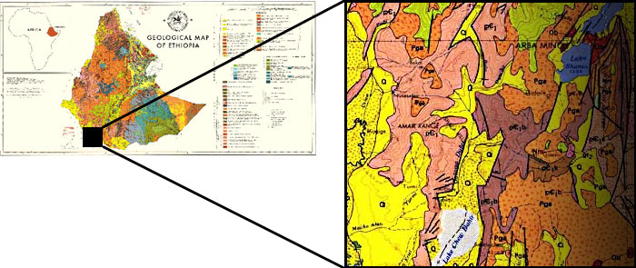
| The colors on this map represent different types of rock of different ages. We’re most likely to find fossils in areas of sedimentary rock (like the yellow zone here on the map) because it’s formed by the slow buildup of layers of sand, mud, and organic matter—that is, dead things. Not all sedimentary rock contains all types of fossils, however. For example, rocks made from ocean sediments aren’t likely to contain the fossilized remains of land animals. A field geologist can help identify the environment where sedimentary soils formed: ocean, lake, river, desert, or bog. | |
|
|
|
|
|
|
|