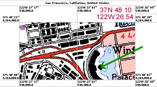

The coordinates of the edges of the map are show because I clicked on "Image Info" after I had zoomed into a view of the Exploratorium. I drawn a green arrow to the location for which I want to obtain coordinates. The frame's lower and upper latitudes are 37N 48' 07" and 37N 48' 20". The point of interest is located 1/4 of the way from the lower boundary to the upper boundary, so it's latitude is computed from (1/4)*(20-7) + 7 = 10". The longitude is similarly computed to be 122W 26' 54", as I've noted in red above the image.
Note: Remember that there are 60 minutes in a degree, written 60', and that there are 60 seconds in a minute, written 60".