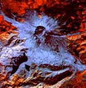
MT. ST. HELENS in the State of Washington, United States of America, continent of North America. This satellite picture was taken in 1994, fourteen years after the spectacular and deadly volcanic explosion of 1980. It is easy to see the area where trees, plants, animals, and people were destroyed. To find out more about the Mt. St. Helen's eruption, go to your local library and check out the books and magazines there and click here

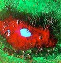
MT. KILIMANJARO between the countries of Tanzania and Kenya, continent of Africa. This beautiful mountain is the highest in Africa (19,340 ft/5,895 m). This picture was taken in February 1993. The two highest peaks of the mountain are covered in snow that appears blue. For more information on Mt. Kilimanjaro, visit your local library where you'll find many books, magazines, and novels about this mighty mountain or click here .

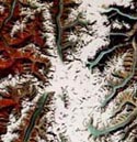
MT. GODWIN AUSTEN also known as K2, in China and Pakistan, continent of Asia. At 28,250 ft/8,611 m, K2 is the world's second-highest mountain. To the northeast of K2 lies the largest desert in the world - the Takla Makan - whose name means "Go in and you won't come out"!!! K2 was not successfully climbed until 1954 by a team from Italy. To find out more information about this mighty mountain and the desert it shares the world with, ask your local librarian for help finding books or click here

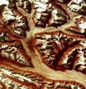
CANADIAN ROCKY MOUNTAINS. This small section is in the provinces of British Columbia and Alberta, Canada, continent of North America. This is the most difficult image to understand. The earth here is extremely twisted and there are shadows which confuse the eye. Scientists who learn how to read these satellite images are very special and have studied for many years. The Rocky Mountains are the longest chain of mountains in North America. There are many books and magazines that can teach you more about these terrific mountains or you can click here.